Shenandoah National Park: The Lush Backyard of the DMV
/If you live in the D.C. area, you’re familiar with the concept of “the DMV”—the sprawling territory that encompasses the District, Maryland, and Virginia. We often think of ourselves as residents of all three areas, even though we live in just one. Commuters may drive two hours to their jobs in the city. Moms and dads shuttle their kids to lessons in another county. And weekend warriors think nothing of heading east to the Chesapeake Bay to kayak, or west to Shenandoah National Park to hike.
Only 75 miles west of the District, Shenandoah is practically in our backyard. For me, living in Alexandria, it’s become my favorite destination on a Saturday or Sunday. Just heading out I-66 to the northernmost entrance at Front Royal lowers my blood pressure, because I know that in only about an hour, I’ll be in the woods.
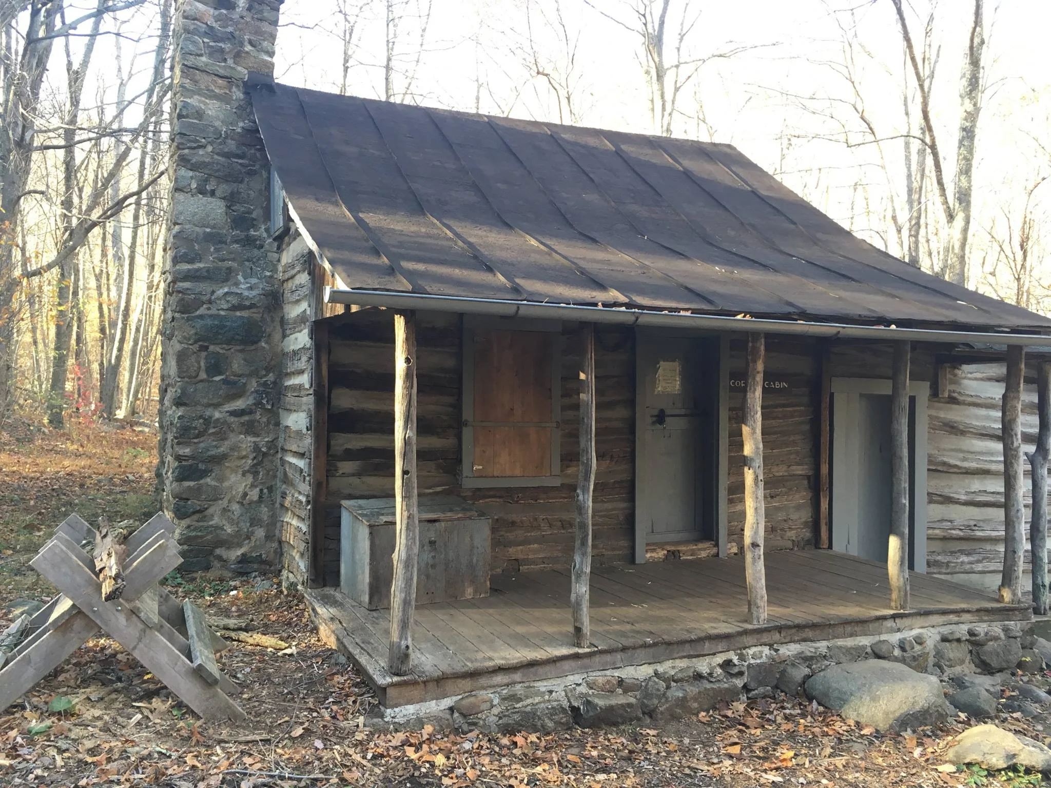
Corbin Cabin is still standing on an old homestead. It can be booked through the Potomac Appalachian Trail Club.
Much of Shenandoah is designated wilderness, the portions of land with special protections that were originally set aside to remain (or be restored to) nature “untrammeled by man.” Other parts of it are national parkland only. Throughout the area, you can find traces of the history through ruins of old farmhouses, stone fences, and cemeteries from the families that used to live in the Blue Ridge Mountains before it was designated as a national park.
Extending from Front Royal for 105 miles south to Waynesboro, Shenandoah is bisected by a sliver of road, the two-lane Skyline Drive. The parkway winds through the woods, expanding to frequent scenic overlooks of hills and valleys. On either side are the mountains of the Blue Ridge.
You can’t find an ordinary view off any of these overlooks—they are all stunning. The wildflowers and grasses next to the low stone wall make up the foreground; the middleground is the layer of trees within the next several hundred feet; and finally, the great vista, encompassing hills and valleys in shades of green and blue. The overall effect is of being on a movie set, with shrubs sharp and vivid against a dreamy painted backdrop.
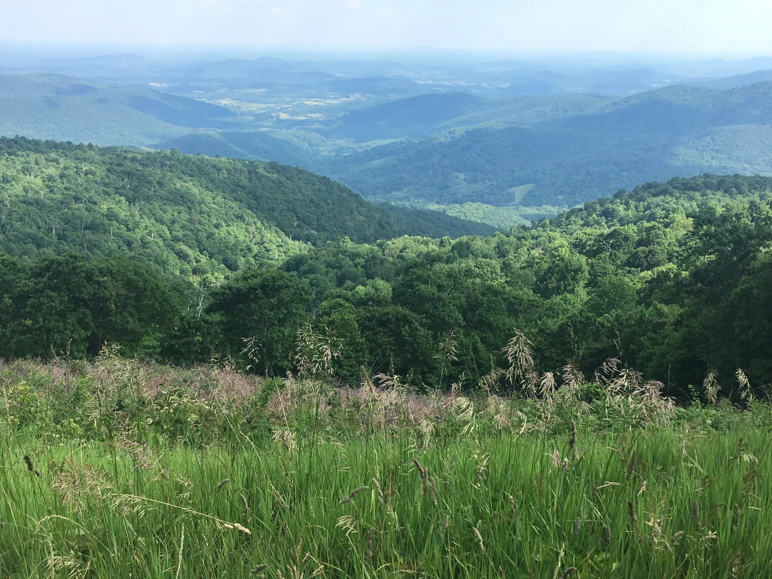
Just one of the many idyllic overlooks off Skyline Drive.
But the real reason to go, at least for me, is the trails. There are over 500 miles of trail in Shenandoah—short hikes and long hikes, flat paths and strenuous climbs, solitary trails and those with plenty of company. You can find hikes with overlooks, through meadows, past historic features, through streams, and up to waterfalls. Over the past couple of years, I've enjoyed quite a few, and already have some favorites.
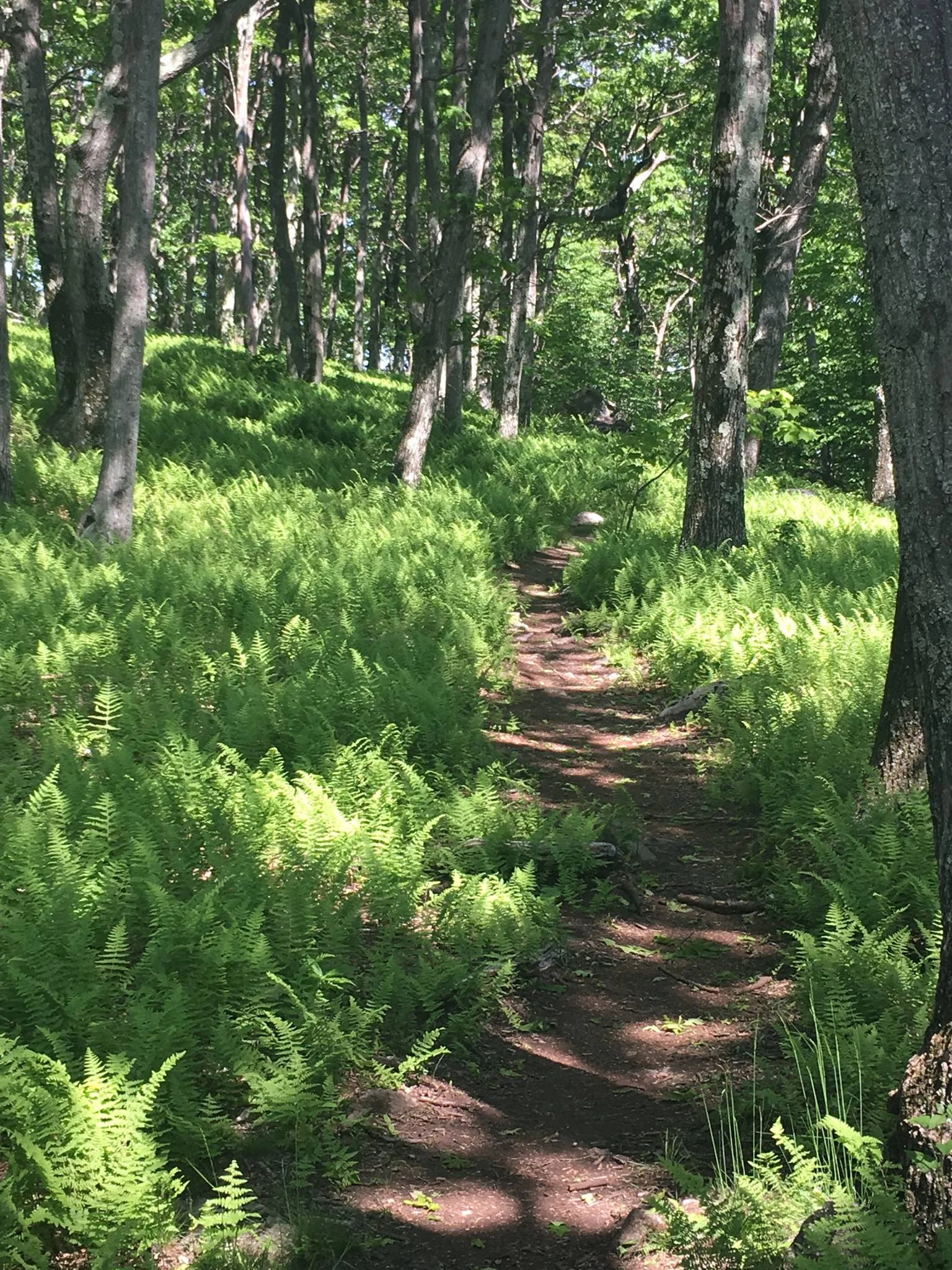
More ferns than you can shake a stick at on this section of Sugarloaf trail.
I love the Compton Gap trail for its closeness to the park's north entrance, its uphill workout, and the spectacular geological formation of "columnar jointing" you can observe. The Snead Farm loop takes you past the remnants of an old farm, with the foundation of the house still intact and the barn kept in very good condition. Jeremy's Run trail takes you across several streams, if you enjoy rock-hopping and potentially getting your boots a bit wet. And the Sugarloaf trail starts near an old Civilian Conservation Corps building and brings you through an especially lush section of ferns.
My next goal is to tackle more of the hikes in the central part of Shenandoah, which will require more driving on my part, but will pay off in access to some of the steeper climbs in the park.

Earned my junior ranger patch. So proud.
You can find details on the various trails on the Shenandoah Suggested Hikes page, if you like to really plan ahead. If you're the spontaneous type, though, stop at the Dickey Ridge Visitors Center, five miles in from the Front Royal entrance gate.
The rangers know these trails backwards and forwards, and will whip a map out from under the desk that exactly matches what you’re looking for in terms of length and difficulty. They highlight the trail for you with marker and tell you about what to expect, as well as any options you have for making a different loop or lengthening your hike to see certain nearby features. I store all these maps in a folder at home, for when I want to re-hike one.
While you’re at the visitors center, check out the small exhibit on the park and any ranger-led programs that are being given that day. I confess to having become a big national parks geek in the past couple of years, and I learned to my delight that you can fill out a junior ranger workbook, no matter what age you are, and earn your ranger badge or patch. They are serious about this—Ranger Larry checked all the pages and even asked me questions about it. The rangers also have a sense of humor: Ranger Thomas even administered the junior ranger pledge to my "hiking hamster" buddy, after checking her diligent work.
Shenandoah National Park is the ideal place to get outdoors, embrace nature and let all the cares of the city fall away from you for a few hours. I've been here in all seasons of the year, and during all sorts of personal challenges, and being here always centers and refreshes me. Do yourself a favor and explore the variety its wilderness has to offer—almost right in your backyard.
Resources:
- Shenandoah’s Suggested Hikes page has a chart of many of the hikes available.
- Hiking Upward is an incredibly useful website with descriptions, photos, and hiker reviews of many hikes in the area, not just in Shenandoah National Park.
- The Virginia is for Lovers tourism website has a Top 10 list of popular Shenandoah hikes.
- I reviewed the nearby Happy Creek Coffee and Tea recently on this blog—it’s my favorite place to stop and revive after a long hike.